| PROPERTY PHOTOS: 1
2
3
4
5
|
PROPERTY INFORMATION AS OF 4/19/2024 11:11:58 PM |
PRINTING |
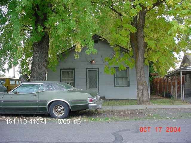 |
Parcel Address: |
119 W ELIZABETH ST, WAPATO ,WA 98951 |
Printer-Friendly Page |
| Parcel Owner(s): |
GALE R BARRETT |
| Parcel Number: |
19111041571 |
Parcel Size: |
0.14 Acre(s) |
| Property Use: |
11 Single Unit |
Detailed Report |
| TAX AND ASSESSMENT INFORMATION |
| Tax Code Area (TCA): |
560 |
Tax Year: |
2024 |
| Improvement Value: |
$47500 |
Land Value: |
$50400 |
Print Detailed MAP |
| CurrentUse Value: |
$0 |
CurrentUse Improvement: |
$0 |
| New Construction: |
$0 |
Total Assessed Value: |
$97900 |
| RESIDENTIAL INFORMATION |
SECTION MAPS |
| Quality |
Year Built |
Stories |
Main SqFt |
Upper SqFt |
Bsmt SqFt |
Bedrooms |
Bathrooms (full/3/4,1/2) |
Garage (bsmt/att/bltin) |
Carport |
Section Map 1in=400ft |
| No Residence Information Found. |
| SALE INFORMATION |
Qtr SECTION MAPS |
| Excise |
Sale Date |
Sale Price |
Grantor |
Portion |
NW-Qtr 1"=200ft
SW-Qtr 1"=200ft
|
NE-Qtr 1"=200ft
SE-Qtr 1"=200ft
|
| No Sales Information Found. |
| DISCLAIMER |
| While the information is intended to be accurate, any manifest errors are unintentional and subject to correction. Please let us know about any errors you discover and we will correct them. To contact us call either (509) 574-1100 or (800) 572-7354, or email us. |
| OVERLAY INFORMATION |
| Zoning: |
|
Jurisdiction: |
Wapato |
| Urban Growth Area: |
Wapato |
Future Landuse Designation: |
(Yakima County Plan 2015) |
| FEMA 100 Year: |
FEMA Map |
FIRM Panel Number: |
53077C1433D |
Download Map |
| LOCATION INFORMATION |
| + Latitude:46ş 27' 13.923" |
+ Longitude:-120ş 25' 18.504" |
Range:19 Township:11 Section:10 |
| Narrative Description: Section 10 Township 11 Range 19 Quarter SE MURRAY'S REPLAT OF LOTS 3 & 4, BLK 6 OF ONTARIO ANNEX TO THE TOWN OF WAPATO: Block 1 Lot 22 |
| DISCLAIMER |
| MAP AND PARCEL DATA ARE BELIEVED TO BE ACCURATE, BUT ACCURACY IS NOT GUARANTEED; THIS IS NOT A LEGAL DOCUMENT AND SHOULD NOT BE SUBSTITUTED FOR A TITLE SEARCH, APPRAISAL, SURVEY, FLOODPLAIN OR ZONING VERIFICATION |


 Map
Map Report
)
)
)
)
)